
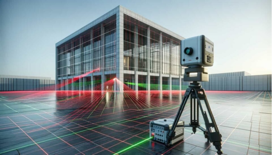
A 3D laser scanner for buildings captures these existing conditions digitally. Instead of measuring every feature separately, laser scanning records the surrounding environment in three dimensions. As a result, it creates detailed data that supports renovation, refurbishment, extension and installation projects. In addition, ASW offers this through its 3D laser scanning service in Abu Dhabi.
Why Existing Buildings Are Hard to Measure Accurately
Existing buildings often contain changes that the original drawings do not show. Common examples include modified room layouts, new partitions and additional pipes and ducts. Likewise, owners change door or window locations, install new equipment and alter ceiling levels. In addition, structural modifications and incomplete or outdated drawings add to the problem.
Therefore, a detailed building scan brings these visible conditions together in one digital reference. For the full survey sequence, see our step-by-step scan walkthrough.
How a 3D Laser Scanner Captures the Existing Building
First, the surveyor places a laser scanner at selected positions inside or around the building. Then the scanner measures visible surfaces and records their location in three dimensions. The main stages include:
Survey planning: First, the team defines the areas to scan and identifies important building elements. Next, it sets the required level of detail and plans suitable scanner positions.
Data collection: The surveyor places the scanner at planned locations and captures the surrounding surfaces. Then, where necessary, the surveyor records additional scan positions.
Scan registration: Next, the team combines the individual scans and aligns the collected data. As a result, it creates a unified point cloud.
Data processing: After that, the team cleans and reviews the point cloud. Then it extracts the required measurements and prepares drawings or digital models.
Final deliverables: Finally, the project receives CAD drawings, point clouds, 3D models and as-built documentation. Teams can also request other project-specific outputs.
For more detail on how field decisions affect the data, read our field workflow and accuracy guide.
What Building Details Can a Scan Capture?
Building scanning captures walls, partitions, floors and ceilings, depending on visibility, access and project requirements. It also records columns, structural elements, doors, windows and staircases. Likewise, it picks up building elevations, exposed pipes, ducts and cable trays. In addition, it captures equipment, machinery, architectural features, irregular surfaces and visible service installations.
Overall, this is especially useful in spaces where taking a large number of individual measurements would take too much time.
When the Scan Reveals Something the Drawings Don’t
Old drawings give useful background information. However, they may not show every modification the building has had.
In contrast, a current scan gives the team a physical reference for comparison. With it, the project team can check existing room dimensions, locate visible structural elements and identify changed layouts. Likewise, the team can review existing service routes and compare current conditions with drawings. Finally, the team can document modifications and support updated as-built information.
Still, the scan records only what is physically visible at the time of the survey. Also, it does not automatically tell you when or why someone made a particular modification. Our guide to building as-built surveys in the UAE explains how teams record these differences.
Using the Captured Data for Renovation and Modification
Renovation work has to fit within an existing structure, so accurate information about the current space matters. Scan data supports new partition planning, extension design and refurbishment work. Moreover, it helps with door and opening modifications, equipment installation and ceiling modifications. It also supports MEP coordination and as-built documentation.
The main advantage is that designers work from current site information instead of relying entirely on older drawings. In addition, current site data supports alteration submissions to the Department of Municipalities and Transport in Abu Dhabi.
Making Existing Spaces Easier to Coordinate
Building projects often involve architects, structural engineers, MEP teams, contractors and other specialists. A shared digital representation helps these teams work from the same existing-condition information. As a result, architectural coordination, structural assessment and MEP planning become easier. Likewise, clash identification, space planning and installation planning benefit from the same reference. It also gives contractors a clear reference and supports design verification.
Planning New Equipment Around Existing Building Conditions
Installing new equipment becomes complicated when space is limited. A building scan helps the team identify visible obstacles and available clearances around the proposed installation area.
Therefore, it is useful for machinery installation, plant rooms and mechanical or electrical equipment. It also helps with service rooms, industrial facilities and equipment replacement projects. As a result, designers can examine existing conditions before they finalise the installation layout. Our post on laser scanning for retrofit projects shows this in more detail.
Turning Scan Data Into CAD and BIM Information
The raw point cloud is not always the final deliverable. Instead, the team can process it into other digital formats, depending on the project’s requirements.
Possible outputs include 2D CAD drawings, floor plans, elevation drawings and sections. Besides these, teams can deliver as-built drawings, 3D models, BIM-related information and point cloud files.
ASW’s CAD services support architectural, structural, civil, MEP, as-built, construction, fabrication and coordination drawing requirements. Then, for intelligent 3D models, our BIM modeling service and scan to BIM guide explain the next step. You can also see how a plan comes together in our post on the as-built floor plan in Abu Dhabi.
Choosing the Right Level of Detail for a Building Scan
Not every project needs the same amount of scanning detail. Before the survey starts, consider which rooms need scanning and which building elements to capture. Also decide whether you need structural details, MEP elements, elevations and sections. Then confirm the required measurement accuracy, level of detail, intended use and file formats.
Therefore, defining these requirements helps the survey team plan the scanning work around the actual purpose of the project.
What to Decide Before Scanning an Existing Building
First, confirm a few project details before fieldwork begins.
Project Requirements
Decide whether you need the scan for renovation, refurbishment or a building extension. In addition, state whether it supports as-built documentation, equipment installation, design coordination or BIM development.
Site Conditions
The survey team should also know about access restrictions, working hours and restricted rooms. Likewise, tell the team about sensitive equipment, occupied areas and areas that furniture or equipment hide. Safety requirements matter as well.
Overall, this information helps the team choose the right scanning approach.
Where 3D Laser Scanning Adds the Most Value
A 3D laser scanner for buildings is particularly useful where conventional measurements alone would take too long or miss detail. Typical applications include older buildings, renovation projects, building extensions and commercial buildings. Likewise, it suits industrial facilities, complex MEP areas and buildings with incomplete drawings. In addition, it helps with refurbishment projects, as-built documentation and equipment installation. It also supports space coordination and heritage structures.
The value of 3D laser scanning stands out when you need accurate information about the existing space for the next stage of a project. For a specific scanner brand, our FARO 3D laser scanner guide covers what that equipment does on site.
Conclusion: Building a Digital Record of the Space You Already Have
Existing buildings can change significantly over time, and their current condition may differ from the original documentation. A 3D laser scanner for buildings gives you a practical way to capture visible existing conditions and convert them into useful digital information.
Once the team processes the data and brings it into CAD, BIM or other workflows, it supports better planning, coordination and documentation. To discuss your building, review our project references or contact ASW.
Frequently Asked Questions
1. Can a 3D laser scanner work on old buildings?
Yes. In fact, 3D laser scanning documents existing buildings, including structures where the available drawings are incomplete or outdated.
2. Can laser scanning help identify differences from old drawings?
Yes. A current scan records existing physical conditions. Then the team can compare them with previous drawings to identify differences.
3. Can you use building scans for renovation projects?
Yes. Scan data also gives you existing-condition information for renovation, refurbishment, modification and extension planning.
4. Can a building scan capture MEP services?
It captures visible elements such as pipes, ducts, cable trays and equipment. However, the result depends on visibility, access and the survey requirements.
5. Can you convert scan data into CAD drawings?
Yes. Surveyors then use processed scan data as a reference to prepare CAD drawings and other deliverables, depending on the required scope.
6. Is 3D laser scanning useful if building drawings already exist?
Yes, because existing drawings may not reflect later changes. A current scan also adds information about the building’s present physical condition.

Pingback: Building As-Built Survey in the UAE: Recording What Was Actually Built - Accurate Survey Work LLC Building As-Built Survey in the UAE: What It Covers and When
Pingback: 3D Laser Scanning Process Explained: Workflow & Accuracy
Pingback: Aerial Mapping in Abu Dhabi: Turning Aerial Data into Clear Project Insights - Accurate Survey Work LLC Aerial Mapping in Abu Dhabi: A Simple Guide for Projects
Pingback: Laser Scanning for Retrofit Projects in Abu Dhabi - Accurate Survey Work LLC
Pingback: 360° Mapping Services in Abu Dhabi for Construction