
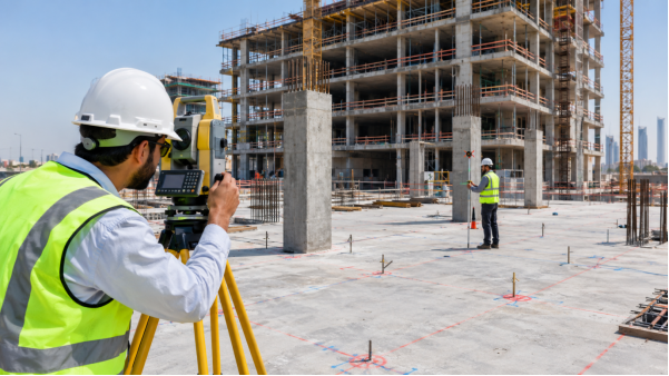
Before any renovation, fit-out or infrastructure project begins, the team needs to know exactly what is on site today. Photographs only capture what the photographer chose to point at, and gaps tend to surface later, when the survey crew has already gone. 360° mapping in Abu Dhabi closes those gaps. The camera records the full surroundings from each capture point, so architects, contractors and consultants can look in any direction and review the site remotely whenever they need to.
This article covers how a 360° site capture is carried out, where it is used across Abu Dhabi’s growing construction sector, and why it delivers the most value when combined with measured surveying.
Why Accurate Site Records Matter in Abu Dhabi
Abu Dhabi’s population grew by 7.5% in 2024 to reach 4,135,985 people, according to the Statistics Centre – Abu Dhabi (SCAD). That is a rise from 2.7 million in 2014. A larger population needs more housing, offices, roads and utilities, and each new project depends on dependable information about the structures and services already in place.
Construction activity reflects the same trend. SCAD data shows the sector grew 13.9% year-on-year in Q3 2025, adding AED 30.5 billion in value and accounting for 9.4% of the emirate’s GDP. With this volume of work under way, a dated visual record of each site helps teams save time and settle disagreements about existing conditions. It also gives consultants, contractors and owners a single reference to work from.
What Is 360° Mapping?
360° mapping captures a site from many positions to build an immersive visual record of the surroundings. Instead of a handful of photographs taken in one direction, the camera records the full sphere around each point. Those captures are then organised into a digital walk-through, so anyone with the link can move from viewpoint to viewpoint and inspect the space on screen.
How a 360° Mapping Survey Works on Site
A typical 360° mapping survey follows these steps:
- Site inspection – understanding the project area and identifying key locations.
- Capture planning – deciding camera positions and the survey route.
- 360° image capture – recording each area from multiple viewpoints.
- Data processing – organising and processing the captured images.
- Quality checking – reviewing coverage and re-capturing any missing areas.
- Digital delivery – handing over the record in a format the project team can open easily.
On larger jobs, the 360° record is often paired with 3D laser scanning, topographic surveying, CAD drawings or BIM models. The imagery gives visual context, while the measurement-based methods supply the dimensions that engineers and designers need.
Abu Dhabi’s Survey Framework and the Role of 360° Mapping
The Department of Municipalities and Transport (DMT) runs a network of 36 reference cadastral stations spread across the emirate, operating 24 hours a day and used for daily surveying transactions such as land delivery. That network is what keeps professional survey work in Abu Dhabi tied to a common, accurate reference.
DMT is also building the Abu Dhabi Digital Twin, a 3D representation of the emirate that combines aerial photography, LiDAR scanning and game-engine technology to support planning and decision-making. A project-level 360° record is a much smaller, site-specific version of the same idea: capture reality digitally, then let people review it remotely.
Where 360° Mapping Is Used
The technology suits almost any project where someone needs to understand existing conditions or track change over time. The most common uses in Abu Dhabi are:
- Construction sites – dated visual records at each stage, useful for progress reviews and for comparing conditions over time.
- Existing buildings – documenting spaces before renovation, refurbishment or extension work begins.
- Infrastructure projects – roads, utilities and public facilities that cover long distances and many locations.
- Commercial and industrial facilities – factories, warehouses and offices where teams plan maintenance or modifications.
- Property and facility management – a visual reference of equipment areas, access routes and finishes for owners and facility teams.
The Practical Benefits
The biggest advantage is that the site can be reviewed after the survey is finished. When someone asks what a corridor looked like before the ceiling came down, the answer is a click away instead of a memory or an old photo.
Remote review is the second big gain. Architects, consultants and project managers can inspect captured areas without travelling to every location, which matters when teams are spread across offices. It also improves communication: instead of describing a problem in words, people can point to the same place in the same image.
One caution applies. 360° imagery is not a replacement for a professional land survey or measured survey. It documents what a place looks like; it does not on its own deliver the accuracy needed for design, setting out or legal boundaries. The right method depends on the purpose and accuracy your project requires.
Conclusion
With Abu Dhabi’s population and construction activity both growing strongly, clear and accessible site records are becoming a basic project need rather than a luxury. 360° mapping provides an easy-to-review visual record of buildings, construction sites and infrastructure, and it gets even more useful when paired with accredited surveying, laser scanning, CAD or BIM.
Frequently Asked Questions
What is 360° mapping used for?
It is mainly used to create a detailed visual record of buildings, construction sites, infrastructure and other physical environments, so teams can review them remotely and refer back to them later.
Is 360° mapping the same as land surveying?
No. 360° mapping focuses on visual documentation, while land surveying provides measured information at the accuracy a project requires.
Can 360° mapping be used on construction projects in Abu Dhabi?
Yes. It is useful for documenting existing conditions, tracking progress, planning renovations and reviewing sites remotely.
Can it be combined with 3D laser scanning?
Yes. Combining the two gives visual context along with detailed measurements, depending on what the project needs.
Why use a professional survey company?
A professional team can pick the right method, capture the site systematically, check the data and deliver usable files. For regulated survey work, accreditation requirements also apply in Abu Dhabi.
