A survey crew on foot can cover a few hundred metres of road in a morning. A vehicle with a scanner on the roof can cover many kilometres in the same time. That gap is where the weeks come from.
This guide explains how mobile mapping works and where it saves time. It starts with the basic idea and moves toward the choices a project team actually has to make.
Driving the Site Instead of Walking It
Traditional survey is slow because a person has to stand at every point they measure. Mobile mapping removes that step. The sensors sit on a vehicle, and the vehicle drives the route.
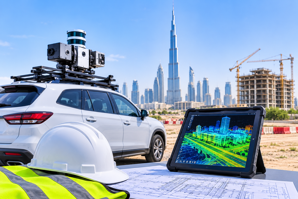
While it moves, the system records millions of measurements. Together they form a dense 3D picture of everything the scanner can see. This includes the road surface, kerbs, signs, poles, bridges and building faces. So the surveyor no longer chooses points one by one. The system captures everything in view, and the team decides later what to extract.
The Kit Behind the Vehicle: Scanners, Cameras and Positioning Units
A typical system has three parts that work together.
- The scanner fires laser pulses and measures how long each one takes to return. This gives distance, and with it the shape of the surroundings.
- The cameras take photos along the route. These give colour to the scan and let you check details by eye.
- The positioning unit combines satellite positioning with an inertial sensor. It tracks exactly where the vehicle is and which way it faces at every instant.
Each part matters because the others depend on it. A great scanner is useless if the system loses track of its own position.
How a Moving Scanner Still Lands Within Centimetres
This is the question most clients ask first. If the vehicle is moving, how can the data be accurate?
The answer is the positioning unit. Satellite signals fix the vehicle’s position. The inertial sensor fills the gaps between those fixes, because it records every small turn, tilt and acceleration. The software then places each laser point in real-world coordinates. Satellites alone are not always enough. Tall buildings, tunnels and bridges can weaken the signal. Surveyors fix this by measuring known control points on the ground and tying the scan to them. Reliable control is what turns a good-looking scan into a trustworthy one.
Planning a Capture Run on a Live Road
The driving itself is the shortest part of the job. The planning decides whether the data is useful. Before the vehicle moves, the team studies the route and decides how many passes it needs. A dual carriageway, for example, usually needs a run in each direction. They also check traffic patterns and pick a time that avoids heavy congestion, because parked vehicles and large trucks can block the scanner’s view.
Satellite conditions matter as well. The crew checks the expected signal quality for the day and plans extra control where the sky is partly blocked. A little planning at this stage prevents a repeat visit later.
From Raw Scan to a Drawing Your Team Can Use
A raw scan is not yet a deliverable. It is a very large collection of points, and it needs processing. In the office, the team first checks and adjusts the trajectory. Then they clean the data, remove noise and moving objects, and align it to the control. Only after that does the extraction start. Depending on the brief, the output can be a point cloud, a terrain model, or features such as kerbs, lane edges and poles.
Finally, the team turns those features into CAD drawings. Many clients also want to compare the result with existing topography data, and the common coordinate system makes that straightforward.
Where the Weeks Actually Disappear: Fewer Closures, Fewer Return Visits
Time savings in mobile mapping come from four places.
- Field time shrinks : One vehicle pass replaces days of walking and measuring.
- Traffic control shrinks : The vehicle travels with the traffic, so you need fewer lane closures and fewer permits.
- Return visits shrink : The scan holds far more than the brief asked for. If the designer later needs one more measurement, the team takes it from the data and does not go back to site.
- Safety risk shrinks : Fewer people stand next to live traffic.
Real authorities already use this approach in the UAE. Dubai Municipality recently completed a pilot survey of waterways using a mobile mapping system mounted on a vessel, as reported by the Government of Dubai Media Office. Research in Abu Dhabi points the same way. One paper on updating the emirate’s basemap found that mobile LiDAR was faster than traditional survey methods and lower in cost.
Picking Between Mobile, Static and Drone Capture for Your Job
Mobile mapping is not the right tool for every site. The best choice depends on the shape and access of the area.
- Mobile mapping suits long, linear, drivable routes. Examples are roads, rail corridors and utility routes.
- Static laser scanning suits buildings, plant rooms, tight interiors and anywhere a vehicle cannot go.
- Drone mapping suits wide open land, stockpiles and areas that are unsafe or hard to reach on foot.
- GPS survey suits control, boundaries and setting out, where a few precise points matter more than a full surface.
Many projects combine two or three of these. A road upgrade, for instance, might use mobile mapping for the carriageway and static scanning for a bridge underside. If buried services are part of the scope, add a utility survey, because a scanner only sees what is above ground.
Conclusion
Mobile mapping saves time because it changes how data is collected. The vehicle captures everything in one pass, and the team extracts what it needs afterward. That means fewer days on site, fewer closures and fewer return trips.
The method works best when the planning and control are done properly. If you have a corridor, road or large site in mind, talk to our team about whether mobile mapping fits it.
Frequently Asked Questions
Is mobile mapping accurate enough for engineering design?
Yes, in most cases, but the result depends on the control. A system tied to well-measured ground points can support design work on roads and corridors. Always ask for the accuracy tolerance in writing before the survey starts, so both sides know what the data is meant to deliver.
Does it still work under bridges and in tunnels?
It does, with extra care. Satellite signals weaken in those places, so the vehicle relies more on its inertial sensor and on control points measured nearby. The surveyor plans this before the run and checks the result afterward.
Do we need to close lanes for the survey?
Usually not. The vehicle drives with normal traffic, which is one reason the method saves time on live roads. Very heavy traffic can still block the scanner’s view, so the team picks a quieter window where possible.
Can mobile mapping replace a topographic survey?
For a long road or corridor, it can often do most of the work. For a small plot, a tight site or an area a vehicle cannot enter, a conventional topographic survey or static scanning is the better fit. Many projects use both.
What should we share with the survey team before the job?
Send the route or site boundary, the drawing format you need, and the coordinate system your project uses. Also mention any areas with restricted access. With those four details, the team can plan the capture and quote the job accurately.