
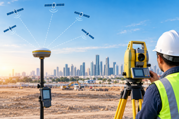
A survey crew pulls up to a freshly cleared plot. The nearest control point is a kilometre away, half the old markers are buried under fill, and the client wants the levels and building corners by evening. Running a traverse back to known stations will eat the morning. Setting up a total station on a guessed position is not an option on a job that has to tie into the project grid.
This is the kind of day a GPS total station is made for. It puts a satellite receiver and a total station into one working setup. The crew can fix where they are and measure what is around them without changing instruments. If you only need satellite positioning, our GPS and GNSS survey service covers that side. This article explains how the hybrid setup works, where it helps and where it does not.
1. What Is a GPS Total Station?
A GPS total station is a total station that works together with a GNSS receiver. The total station does what it always does: it measures horizontal angles, vertical angles and distances to a prism or a reflective target. The receiver adds the one thing a total station cannot get on its own, which is a position on the ground in real coordinates.
Manufacturers build it in two ways. In the integrated type, a small GNSS antenna sits on top of the total station and both share one controller and one set of field software. In the paired type, the crew uses a separate receiver and total station linked through the same data collector. The receiver fixes the points the total station needs. The field routine is almost the same either way. The instruments we run on site are listed on our survey equipment page.
2. Main Components of a GPS Total Station
- Total station: measures angles and distances, usually with a motorised drive and a prism or reflectorless mode.
- GNSS antenna and receiver: the satellite side of the setup, mounted on the instrument or carried on a pole.
- Data collector with field software: runs both devices, stores the observations and does the coordinate calculations.
- Correction link: a radio or mobile connection that brings in RTK corrections from a base station or a correction network, when the job uses RTK.
- Tripod, prisms and rover pole: the prism is what the total station aims at, and the pole carries the receiver when it is used as a rover.
3. How a GPS Total Station Works
The work has two parts that meet in the data collector. First, the receiver works out where the instrument is standing. With RTK this takes a few seconds once the receiver has a fixed solution. The coordinates go straight into the setup screen. Second, the total station needs a direction. Satellites give a position, not an orientation. So the crew still sights a second point, called the backsight, whose coordinates are known or have just been measured with the GNSS rover. After the instrument height is entered, every angle and distance the total station measures turns into coordinates in the same system as the satellite position.
That is the whole idea. The satellites decide where the instrument is, and the total station decides where everything else is in relation to it. For how satellite positioning is used on UAE projects more broadly, read our guide to GPS land surveying.
4. Setting Up a GPS Total Station Without Control Points
When a site has no usable control nearby, the usual routine looks like this:
- Choose a spot with a clear view of the sky and a clear view of the area to be surveyed. On many sites these two needs pull in different directions, so a few minutes of walking around pays off.
- Level and centre the instrument, then measure the instrument height carefully. A wrong height goes straight into every elevation that follows.
- Let the receiver reach a fixed solution and accept the position.
- Set a backsight point some distance away, measure it with the GNSS rover, and orient the total station to it. A longer backsight gives a steadier direction than a short one.
- Check the setup before measuring anything. Shoot a known marker, a kerb corner or any point already measured by another method, and compare the result.
No control points does not mean no checks. If the project works to a particular grid or height datum, agree with the consultant beforehand how the satellite coordinates will be tied to it. Government networks help here. Abu Dhabi Municipality runs reference cadastral stations that operate around the clock for survey work, and the geodesy section of Dubai Municipality is responsible for that emirate’s geodetic survey and control points. Where a project needs established control of its own, our control point establishment service can set it up.
5. Accuracy of a GPS Total Station
A GPS total station has two accuracies, and they should not be mixed up. The position of the setup comes from the satellite side. With RTK this is generally good to a couple of centimetres horizontally and a little worse vertically. The relationship between points measured from one setup comes from the total station. That is far tighter, down to millimetres on distance and a few seconds of arc on angle.
So the points fit well with each other, while their position on the project grid is only as good as the satellite fix and the backsight. For most topographic and layout work this is more than enough. Where it is not, the crew ties the setup to established control. The errors that cause trouble in practice are ordinary ones: a mis-measured instrument height, a poor satellite view beside large glass or concrete faces that bounce signals, loose centring and very short backsights. Heat shimmer on long sights across hot ground is another.
6. Applications of a GPS Total Station in Land Surveying
- Topographic surveys of large or newly cleared plots, where control is sparse and the crew needs to start quickly.
- Setting out building corners, roads and services on sites where earlier markers have been lost or disturbed.
- Detail surveys beside structures, where the receiver fixes the setup in the open and the total station reaches the facade, kerbs and utilities that satellites cannot see.
- Corridor work such as roads and pipelines, where the setup moves often and re-establishing control at each position would cost too much time.
- As-built checks that need points tied to the project coordinate system without a long traverse.
7. GPS Total Station vs Separate GNSS Receiver and Total Station
A GPS total station is not always the better choice.
On a wide open site where nothing needs a total station, a GNSS rover alone is faster. Inside buildings, under cover or in tight streets, the total station works from existing control and the satellite half adds nothing. The hybrid setup earns its cost on jobs that move between open ground and obstructed areas, or that have little control at the start.
There is also the crew to think about. A hybrid setup asks the party chief to be comfortable with both methods, including the settings and checks on each side. A team already running a receiver and a total station on one project can often get the same result with separate instruments and shared control points. Whatever the setup, the field data still has to reach the drawing board, which we cover in our post on total station data for CAD, BIM and GIS.
Conclusion
Satellites tell the crew where they are, and the total station tells them what is around them. Putting the two together saves the time spent looking for control points and re-setting up, especially on large or new plots. It does not replace every instrument on every job. Where the sky is open, the receiver carries the work, and where it is blocked, the total station finishes it. A survey team that understands both halves can pick the right mix for each site instead of forcing one tool to do everything. To talk through a project, contact our survey team.
Frequently Asked Questions
1. What is a GPS total station?
It is a total station combined with a GNSS receiver, so one setup can fix its own position from satellites and measure angles and distances to nearby points.
2. Is a GPS total station more accurate than a normal total station?
Not for detail measurement, which is still done by the total station. The satellite side fixes the position of the instrument and does not improve the angle and distance readings.
3. Can it work without known control points?
It can fix its own position from satellites, which reduces the need for existing control. Surveyors still check the result against known points where the project requires it.
4. Does it work inside buildings or under cover?
The satellite part needs a clear view of the sky. Under cover or near tall structures, the survey relies on the total station, using points fixed earlier.
5. When is a GPS total station worth using?
On large or open sites, new developments with little control, and jobs that mix wide-area positioning with close detail measurement.

Pingback: GPS Theodolite in Modern Surveying: What It Means and Which Instruments Are Actually Used - Accurate Survey Work LLC GPS Theodolite: What It Is and What Surveyors Use
Pingback: GPS Static Survey: Why Some Control Points Need Hours, Not Minutes - Accurate Survey Work LLC GPS Static Survey: How It Works and When to Use It
Pingback: GPS Topographic Survey: How Satellite Points Turn Into Contours - Accurate Survey Work LLC GPS Topographic Survey: From Satellite Points to Contours