
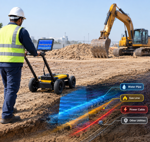
A plot can look completely clear. Flat sand, a few pegs, nothing in sight. Then the first bucket goes in and hits a water line nobody knew about. Work stops, someone makes phone calls, and the schedule slips by days.
Most of these strikes happen because the drawings were old, incomplete, or never updated after the last contractor left. A radar utility survey exists to close that gap before anyone digs. It is one part of the wider range of land survey services a project needs before work begins.
Why Underground Utilities Are a Construction Risk
Everything below the surface is a guess until someone checks it. Water mains, power cables, telecom ducts, drainage lines and old abandoned services can all share the same strip of ground, and they rarely sit where the records say they do.
A strike on any of them can mean:
- A power cut
- A flooded trench
- An injured worker
- Repair bills and a stop-work order
Checking the ground first costs far less than any of these. Surface checks help too. Aerial mapping shows you the levels and layout of the plot, but it cannot show what is buried, which is why the two are used together.
How Ground Penetrating Radar Works
Ground penetrating radar, or GPR, uses an antenna that is pushed along the surface like a small cart. In simple terms:
- The antenna sends short pulses of radio energy into the ground.
- When a pulse meets something different from the surrounding soil, such as a pipe, a cable bundle or a void, part of the signal bounces back.
- The unit records how long each echo takes to return, and the survey team reads those echoes as a picture of what lies below.
Because the signal does not need metal to reflect, radar can pick up plastic and concrete services that a basic cable locator would miss. That is the main reason it is used so widely before excavation.
What a Radar Utility Survey Can Detect
On a typical site, the scan picks up:
- Water and sewer pipes, both metal and plastic
- Electrical and telecom cables, and the ducts that carry them
- Drainage lines and culverts
- Abandoned services that are no longer on any drawing
- Voids, buried tanks and old foundations
The survey reports position and approximate depth. That tells an engineer not just that something is there, but whether it sits clear of the planned trench or right in the way. When the findings are combined with a topographic survey, the design team sees surface levels and buried services on one drawing.
The Survey Process, Step by Step
A radar utility survey follows the same basic sequence on most sites:
- Site visit and records review: The team walks the site and checks whatever drawings and utility records exist, so they know what to expect before scanning begins.
- Radar scanning: The GPR unit is pushed across the area in a grid or along set lines, picking up buried pipes, cables and voids.
- Electromagnetic locating: Cable locators run alongside the radar to confirm live cables and metallic lines.
- Ground marking: Each detected service is marked on the ground as the team goes, so the site team can see it straight away.
- Position fixing: The marks are fixed with a total station or GPS equipment and tied to the site’s control points, so every service has accurate coordinates.
- Utility plan: Back in the office, the data becomes a utility plan through our CAD services, ready for the design team to use directly.
Conclusion
A radar utility survey shows you what is buried before the first cut, while changes are still cheap. For excavation in Abu Dhabi, our utility survey service is a simple way to protect your schedule and your crew. Contact us to discuss your site.
Frequently Asked Questions
1. What is a radar utility survey?
It is a non-destructive survey that uses ground penetrating radar to locate buried pipes, cables and other services, along with their approximate depth and position, before excavation begins.
2. Can radar detect plastic pipes?
Yes. Radar does not depend on metal to reflect a signal, so it can usually detect plastic and concrete pipes that a basic cable locator would miss. Results still depend on ground conditions.
3. How deep can a radar utility survey detect?
Depth varies with the soil. In dry, sandy ground radar can see several metres, but wet, salty or clay-heavy soil reduces the range considerably.
4. How long does a survey take?
Small plots can often be scanned in a day. Larger sites take longer, and the drawings follow once the field data has been processed.
5. What do I receive at the end of the survey?
You receive a utility plan, usually in CAD, showing the position and estimated depth of the detected services, tied to the site coordinates.
