
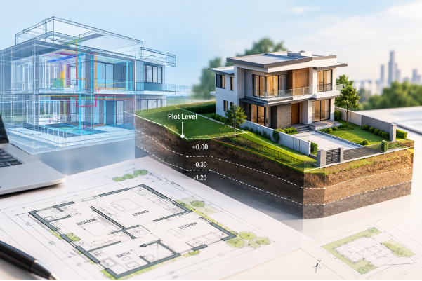
Civil engineering starts with the ground. A road follows the terrain, a drain follows gravity and a bridge crosses whatever is in the way. So when building information modeling moves from buildings into civil work, the ground has to move into the model with it. This blog explains how that works, step by step, from the basic idea to checking what was built.
What Is Building Information Modeling in Civil Engineering?
Building information modeling, or BIM, is a 3D model that carries information along with its shape. In civil engineering, the model covers infrastructure such as roads, drainage, utilities, bridges and earthworks. Each part holds details like its level, length, material and quantity.
The idea is the same as BIM for buildings, but the subject is different. Instead of rooms and floors, the model deals with alignments, slopes and long stretches of land. It gives designers, contractors and authorities one source to work from, in place of separate sets of drawings. This is the kind of model our BIM modeling team builds for projects across the UAE.
How Civil Projects Differ from Building Projects
A building sits on one plot and is mostly above ground. A civil project can stretch for kilometres, cross different soil and levels, and touch land controlled by many parties. It also has far more going on underground: pipes, cables, culverts and old structures that nobody drew accurately.
Two things follow from this. The ground becomes the main design input rather than a background, and the project has to answer to more outside parties, such as road authorities and utility owners. A model helps because the terrain and the services can be seen in the same place.
Where the Ground Becomes Part of the Model
Everything in a civil model rests on how well the ground is known. A topographic survey records the levels and features across the site, and from those readings the team builds a surface model of the existing ground.
Control points tie the survey and the design to the same reference, so a road drawn on screen can be set out in the right place on site. Over a long corridor, a small error at one end can grow into a large one at the other, which is why this stage should not be rushed. A model built on rough ground data looks convincing and still gives the wrong answers.
Modelling Roads, Drainage and Utilities
With the ground in place, the design goes on top. A road is modelled along its alignment, with its profile and cross-sections showing how it rises, falls and sits within the land. Drainage depends on gravity, so its levels have to be exact. A pipe laid a little too flat will not clear itself.
Services need the same care. Existing pipes and cables are placed in the model from a utility survey, so the designer can see where a new line will cross an old one before a trench is opened. Anything the survey did not find stays a risk, so the model should always show how reliable each piece of data is.
Bringing Bridges and Structures onto the Same Model
Bridges, culverts, retaining walls and similar structures join the same model as the road they serve. The abutments, piers and girders are modelled with their dimensions and quantities, and they sit at the right levels against the approach road instead of in a separate set of drawings. The design team can then check that the structure and the road meet properly.
Construction drawings for each part can be issued from the current model through our CAD services team, so the sheets on site match the design.
Planning Earthworks, Quantities and Sequence from the Model
Earthworks are one of the largest costs on many civil projects, and the model is a good tool for them. By comparing the existing ground surface with the designed surface, the team can estimate how much material must be cut and how much must be filled. The model can also help plan the order of work and the movement of material across the site.
A caution applies here. These volumes are only as reliable as the ground survey behind them. A sensible team checks key figures against the survey, and against what the site shows as work moves ahead.
Keeping the Model True to What Gets Built
A civil model drifts away from the real project as work goes on, because levels get adjusted and details change on site. So the last stage is measuring what was actually built. A final survey of the completed ground, road levels and drainage shows how close the work came to the design.
For structures, 3D laser scanning records the actual dimensions, which can be compared with the model. The corrected, as-built model then becomes a useful record for the client, the authorities and anyone who has to build next to or beneath the works later.
Conclusion
Building information modeling in civil engineering works best when it follows the nature of the work: the ground first, then the roads and services, then the structures and earthworks, and finally a check of what was built. When the survey is accurate and the model is built on it, the design and the site tell the same story. If you are planning a civil or infrastructure project in Abu Dhabi, get in touch with our team at Accurate Survey Work and we can help from the first survey onward.
FAQs
1. What is building information modeling in civil engineering?
It is the use of a 3D information model for infrastructure such as roads, drainage, utilities and bridges, with levels, materials and quantities attached to each part.
2. How is it different from BIM for buildings?
Civil models cover long stretches of land and depend heavily on terrain and underground services, while building models focus on a single structure on one plot.
3. Why does a civil BIM model start with a survey?
Because the ground is the main input. Accurate levels and control points keep design errors from carrying into the build.
4. Can the model help estimate earthworks?
Yes. Comparing the existing and designed ground surfaces gives an estimate of cut and fill, though the result is only as good as the survey data behind it.
5. Is civil BIM only for large infrastructure projects?
No. Smaller jobs such as site roads, drainage and utility corridors also benefit from having levels and services checked together before work starts.
