
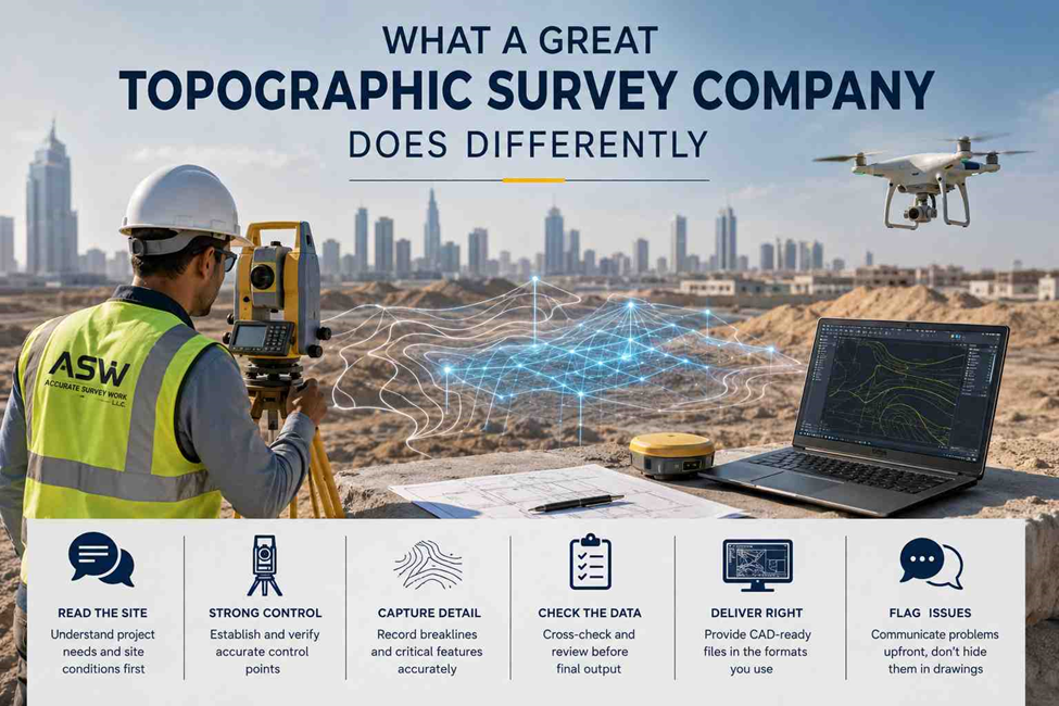
Ask ten survey companies for a topographic survey and most of them will hand you back the same thing: a set of points, a few contour lines, and a CAD file you’re expected to just trust. On paper, it looks like every other quote you’ve collected. The differences don’t show up in the proposal they show up three weeks later, when your design team either builds on solid ground or discovers the levels don’t add up.
The UAE’s construction pipeline isn’t slowing down either the market is on track to grow past AED 127 billion in 2026 alone, with infrastructure and transportation projects now expanding faster than residential work. That means more sites, more terrain complexity, and less room for a survey that only looks accurate on the surface.
So what actually separates the survey companies worth trusting from the ones that just get the job done?
They Read the Site Before They Touch the Equipment
A rushed topographic survey starts with the total station. A good one starts with a conversation what’s the site being used for, what will the design team need from the data, and what parts of the terrain actually matter to the outcome.
- They ask what the survey feeds into before deciding how to run it a topographic survey for earthworks needs different detail than one feeding a drainage design
- They walk the boundaries and access points first, so the fieldwork plan matches the real site, not just the site plan
- They flag terrain complications slopes, water bodies, dense vegetation, restricted zones before the crew mobilizes, not after
Their Control Network Isn’t an Afterthought
Every point on a topographic survey is only as good as the control it’s tied to. This is the part clients rarely see, and it’s exactly where shortcuts happen.
- They establish and check control points before collecting a single detail point, not after
- They tie the site into the coordinate and level reference the project actually requires, rather than defaulting to whatever’s convenient
- They re-verify control during longer surveys, because a control point that drifts halfway through a project quietly throws off everything measured after it
They Capture Breaklines and Detail, Not Just Points
A cloud of elevation points looks impressive until someone tries to build a usable terrain model from it. Ground doesn’t change in straight lines between random dots it changes at ridges, kerbs, drains, and edges. A survey that skips this step hands over a model that looks smooth but hides the details that matter.
- They capture breaklines along kerbs, ditches, retaining walls, and slope changes, not just a grid of random shots
- They record enough detail around drainage paths and low points that the terrain model actually reflects how water will move across the site
- They combine ground methods with drone mapping or 3D laser scanning where the terrain or site size calls for it, instead of forcing one method to cover everything
Data Gets Checked Before It Leaves the Office
Fieldwork is only half the job. What separates a reliable survey from a risky one usually happens after the crew has already left site.
- They cross-check field observations against control before drawings are even started
- They compare new data against any existing records for the site and flag discrepancies instead of quietly overwriting them
- Someone other than the person who collected the data reviews it before it’s signed off
They Deliver in the Format Your Team Actually Uses
A technically accurate survey still causes delays if the output doesn’t match what your design or approval process needs.
- They confirm upfront whether you need AutoCAD, Civil 3D, BIM-ready files, or GIS formats, instead of sending one default package
- Their CAD services produce drawings your consultant can actually work with, not just a picture of the terrain
- They explain what’s included in the deliverable contours, DTM, coordinate schedules, survey report so nothing gets assumed and then missed
They Flag Problems Instead of Burying Them in the Drawing
This is probably the biggest difference, and it’s the one that’s easiest to miss when you’re comparing quotes. A weak survey team hands over a drawing and moves on. A strong one tells you what the data actually means for your project.
- If the site doesn’t match old drawings or assumptions, they say so directly instead of leaving you to find out during construction
- If ground conditions affect the original survey scope, they communicate it before it becomes your problem on site
- They stay reachable if a question comes up after handover, rather than treating the drawing as the end of the relationship
At Accurate Survey Work L.L.C., our approach to every topographic survey follows this process from control setup through to final CAD deliverables built around equipment and methods detailed on our survey methodology and survey equipment pages. If you have a site that needs accurate terrain data, get in touch with our team.
