
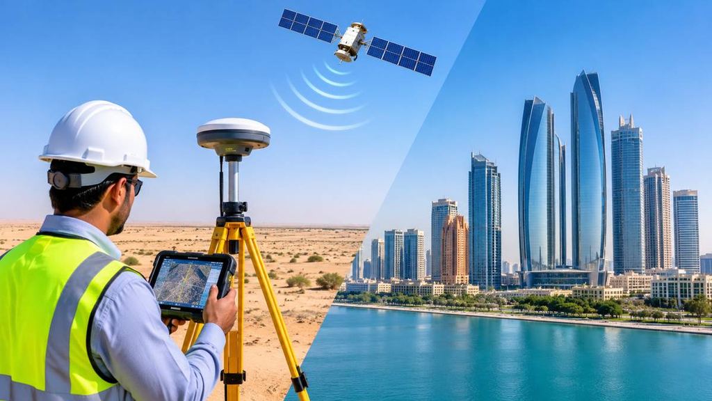
Ask a surveyor in Abu Dhabi about satellite work and you will hear the same answer: it depends where you stand. On an open plot outside the city, a receiver locks on within seconds. Put the same receiver beside a tower on Al Reem Island and it starts to struggle. The equipment is identical. The sky is not.
What Is Satellite Surveying?
Satellite surveying finds a point’s position on the ground using signals from navigation satellites. A receiver sits on a pole, listens, and works out its own coordinates. We then use those coordinates to mark a boundary, set out a building or map a site.
Most people call it GPS. GPS is only one of the systems, though. The correct term is GNSS, and our GPS survey work uses several systems at once.
GNSS Constellations Used in Survey Work
Survey receivers track GPS, GLONASS, Galileo and BeiDou together. Why bother with all four? Every extra satellite helps, and between tall buildings you often cannot see many. A large tower can block half the sky. A receiver tracking GPS alone may give up there, while one tracking four systems usually finds enough satellites to carry on.
How Satellite Positioning Works
Each satellite broadcasts where it is and the exact time it sent the signal. The receiver times that journey and turns it into a distance. Four satellites give it enough to calculate a position and correct its own clock. More satellites make the answer stronger.
Survey receivers also read the carrier wave of the signal. That detail takes the result from metres down to centimetres. For a closer look at how a signal becomes a usable point, read our guide on surveying in GPS. Equipment still matters too, so ask any surveyor which survey equipment they bring to site.
Correction Methods: RTK, Post-Processing and PPP
A receiver working alone can drift by a few metres. The atmosphere bends the signal, and satellite clocks and orbits carry tiny errors. Nobody can build a foundation on that, so we apply corrections. There are three common ways to do it.
RTK sends corrections live from a base station or a reference network. It suits setting out and detailed mapping, and our article on kinematic GPS surveying shows how teams use it on the move. Abu Dhabi also has its own network of permanent GPS reference stations, which supports RTK across the emirate. On the screen, you wait for the receiver to move from a “float” to a “fixed” solution. Only a fixed solution is worth trusting.
Post-processing records raw data and corrects it later in the office. It works well for control points and long observations.
PPP uses precise satellite data instead of a nearby base. It takes longer to settle, but it helps where no base is within reach.
Coordinate Systems and Height Datums in Abu Dhabi
Good satellite data can still land in the wrong place. Satellites work on the WGS84 datum, but Abu Dhabi projects follow the emirate’s own spatial reference standards. The emirate also spans two UTM zones, 39N and 40N, so a surveyor must confirm which zone and system the drawings use before the first measurement. Older drawings may sit on an earlier local datum and need a proper transformation first.
Heights cause even more headaches. A receiver measures height above an ellipsoid, but project levels follow a local height datum. Surveyors bridge that gap with a geoid model, and skipping the conversion puts every level on the drawing out of place.
Check the converted data against known control points before you trust it. For official requirements, confirm the current rules with the Department of Municipalities and Transport.
Best Applications for Satellite Surveying in Abu Dhabi
Open sites suit satellite surveying best. Large plots, road and utility corridors, desert land, and reclaimed island areas all work well, especially where fixed marks are scarce. A topographic survey on this kind of ground goes much faster with satellites, and a GPS topographic survey shows how those points become contours.
The big advantage is simple. A total station needs a clear line from one point to the next. A satellite receiver only needs a clear view of the sky, so on a long corridor you save days. The same approach helps with gate level computation, where reliable levels at plot boundaries matter.
Signal Limitations in Urban and Enclosed Areas
Dense parts of the city are tough places for a receiver. Glass and steel bounce signals around, so the receiver measures a path longer than the real one. Surveyors call this multipath. Car parks, tunnels and basements make it worse.
We check satellite availability before the visit and avoid setting up next to large reflective walls. If a reading looks doubtful, we observe it again later in the day, when the satellites have moved. When the sky stays blocked, we switch to a total station and tie it back to the satellite control. Inside buildings, we use 3D laser scanning, since satellite signals do not reach indoors.
Conclusion
Satellite surveying is fast, and it covers big areas without needing line of sight. The receiver is only the start, though. The result depends on the correction method, on the coordinate and level system, and on a simple check against a known point. Do those three things and the numbers will hold up on site and with the authorities.
Frequently Asked Questions
1. Is satellite surveying the same as GPS surveying?
Almost. GPS is one satellite system. Satellite surveying uses GPS, GLONASS, Galileo and BeiDou together.
2. How accurate is it in Abu Dhabi?
With RTK or post-processing, it reaches centimetre level in open areas. Near tall buildings, accuracy drops unless the surveyor manages signal bounce.
3. Does it work between high-rise towers?
Sometimes. A multi-constellation receiver helps, but a total station often gives the better result in tight spots.
4. Why do coordinates and levels need converting?
Satellites report WGS84 positions and ellipsoidal heights. Abu Dhabi projects use local coordinate and height standards, so the data needs the right conversion. Without it, points and levels shift.
5. Can it survey indoors or underground?
No. Satellite signals do not reach basements or interiors, so surveyors use other instruments there.