
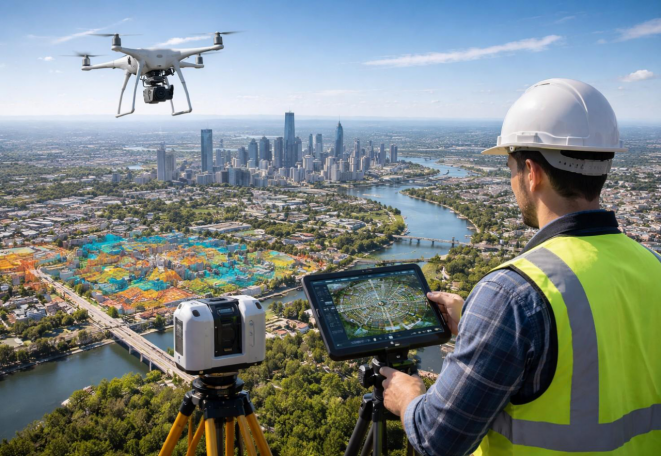
Planning a construction or land development project starts with understanding the site. Ground photographs show individual features, but they may not provide a consistent, measurable view of the whole area.
An orthophoto survey in the UAE turns aerial photographs into a geometrically corrected, georeferenced map. When properly processed and checked, it helps teams review visible site features and measure them within the map’s verified accuracy limits.
What is orthophoto survey
An orthophoto survey is a mapping technique that uses aerial images captured by drones or aircraft to create a detailed view of the ground. The images are processed to correct distortions caused by camera angles and terrain variations, making them more suitable for accurate mapping and measurement.
Orthophoto surveys are widely used in land development, construction, road planning and infrastructure projects. They help surveyors and engineers understand existing site conditions, identify visible features and make better-informed project decisions.
Why Orthophotos Improve Mapping
A standard aerial photograph can show distortions caused by camera perspective and changes in ground elevation. An orthophoto corrects these effects and places the image within a defined coordinate reference system.
- Consistent location reference: Supports mapping within a defined coordinate system.
- Wider site coverage: Combines corrected images into a continuous map.
- Clear site overview: Shows visible features such as roads, buildings and access routes.
- Project coordination: Can be used with compatible CAD and GIS data.
.
Where Orthophoto Mapping Is Useful
Land Development and Site Assessment
An orthophoto helps teams review visible site features, including roads, buildings, fences and access routes. It supports early planning, but visible fences or walls should not be treated as legal boundaries without appropriate survey records.
Roads and Infrastructure
For road and infrastructure projects, an orthophoto provides an overhead view of road connections, nearby structures and access conditions. It can help teams identify areas that need closer investigation.
Construction Progress
Orthophotos captured at different times can document visible site changes, such as new structures or access routes. They do not, by themselves, confirm ground-level changes or earthwork quantities; these require suitable elevation data or additional survey measurements.
Site Coordination
An overhead map can help teams review storage areas, temporary facilities and site access. Construction positions and levels still need to be established through appropriate setting-out surveys.
If elevation or contour information is also needed, a topographic survey may complement the orthophoto.
How Is an Orthophoto Created?
1. Define the Requirements
The survey team confirms the site boundary, coverage, intended use, coordinate reference system and required accuracy.
2. Establish Survey Control
Where required, ground control points connect the aerial imagery to known coordinates and help verify its position.
3. Capture Aerial Images
A drone or suitable aerial platform captures overlapping photographs. Image quality, shadows, surface conditions and site restrictions can affect the results.
4. Process the Images
Photogrammetry software matches features across images, corrects geometric distortions and combines the corrected photographs into an orthomosaic.
5. Verify the Final Map
The completed map is checked against project specifications. Where required, independent checkpoints help assess positional accuracy. A sharp-looking image is not automatically an accurate map.
Where positioning and survey control are needed, review ASW’s GPS and GNSS surveying services and confirm the scope with the survey team.
What Deliverables Can Be Included?
Deliverables depend on the agreed scope and may include:
- Georeferenced orthophoto: A corrected aerial image tied to a coordinate reference system.
- Orthomosaic: A continuous map assembled from corrected photographs.
- Digital files: Formats such as GeoTIFF, when requested and supported.
- Control and accuracy records: Supporting coordinates and verification details, if included.
- Additional outputs: Elevation models, contours or CAD drawings when separately commissioned.
Confirm file formats, coordinate systems, accuracy requirements and deliverables before fieldwork. An orthophoto does not automatically include elevation models or CAD drawings.
For drawing-related requirements, explore ASW’s CAD and surveying services and confirm which outputs are available for your project.
Orthophoto vs. Standard Aerial Photography
| Feature | Standard Aerial Photo | Orthophoto |
| Main use | Visual overview | Mapping and spatial analysis |
| Geometric correction | Not always applied | Applied during processing |
| Georeferencing | May be absent | Included when prepared for mapping |
| Measurements | May be unreliable | Possible within verified accuracy limits |
| CAD/GIS use | Depends on available data | Possible with compatible references |
What Affects Orthophoto Accuracy?
Accuracy depends on the complete survey workflow, not just image resolution. Key factors include:
- Image quality and resolution: The detail captured in each photograph.
- Camera and flight conditions: Calibration, lighting and image clarity.
- Survey control: The quality and distribution of control points or positioning data.
- Surface conditions: Vegetation, shadows and reflective or obstructed areas.
- Processing and verification: The correction method and checks against project requirements.
Agree the required accuracy before the survey and verify the finished map against that requirement.
Conclusion
An orthophoto survey turns aerial photographs into a corrected, georeferenced map that supports site assessment, infrastructure planning and construction documentation. Its usefulness depends on appropriate survey control, processing and accuracy checks.
If your project also needs ground levels, contours or CAD outputs, these should be included in the agreed scope. Contact Accurate Survey Work L.L.C. (ASW) to discuss orthophoto mapping requirements in Abu Dhabi.
Frequently Asked Questions
What is an orthophoto survey?
It converts aerial photographs into a geometrically corrected, georeferenced map that can be measured within its verified accuracy limits.
Is an orthophoto survey the same as a drone survey?
No. A drone survey is a data collection method; an orthophoto is one possible output from the imagery.
Can distances be measured on an orthophoto?
Yes, if the image is properly processed and georeferenced, and measurements stay within its verified accuracy limits.
Does an orthophoto show ground levels?
Not on its own. Ground levels require suitable elevation data or additional surveying.
What affects orthophoto accuracy?
Image quality, camera calibration, survey control, surface conditions, processing and independent checks.
Can orthophotos be used with CAD or GIS?
Yes, when the file format and coordinate reference system are compatible with the project data.
How can I arrange an orthophoto survey in Abu Dhabi?
Share the site location, coverage, intended use, required accuracy and deliverables with a survey provider.
