
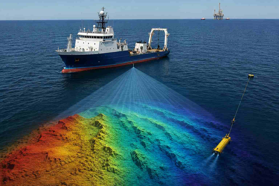
Accurate seabed mapping depends on more than the echo sounder used on a survey vessel. Tidal levels, vessel movement, sound velocity, positioning, seabed conditions and data processing can all influence the final depth model. Small errors introduced during field acquisition can also become significant when the data is used for dredging, navigation channels, marine construction or offshore works.
1. Tidal Corrections: Why Water-Level Changes Affect Seabed Elevations
- The sea rises and falls with the tide, so a depth reading at 9am and one at 3pm off the same spot won’t match unless tide is factored in
- Tidal ranges vary by location and season some coastal shelves swing over a meter, while sheltered basins barely move
- The UAE’s National Center of Meteorology tracks tidal movements and sea conditions across the Arabian Gulf and Sea of Oman daily through its official Al Bahar marine services platform, which surveyors reference for tide timing in coastal work
- Chart datum is usually set to the lowest expected tide, but project datum can differ, and that has to be agreed before survey starts
- Every sounding gets its own tide correction based on the exact moment it was taken this reduced value is what ends up on the final chart or dredge calculation
2. Vessel Motion: Controlling Heave, Pitch and Roll in Sounding Data
- An IMU tracks the vessel’s tilt and movement in real time, and it’s only as reliable as how well it was calibrated before the job
- Heave is the vessel bobbing with the swell left uncorrected, the seabed in the data appears to bob the same way
- Pitch and roll change the angle the sound pulse leaves at, which shifts where it actually hits the seabed, especially on the outer beams of a wide swath
- Motion data and depth data need to sync to the millisecond, or the correction doesn’t match the ping it’s meant to fix
- Even moderate sea states can introduce several centimeters of motion-related error the IHO S-44 Standards for Hydrographic Surveys set the accuracy thresholds surveys are expected to meet despite this
3. Sound Velocity: The Hidden Variable Behind Echo-Sounder Errors
- Sound doesn’t move at one constant speed through water it changes with temperature, salinity, and depth
- Since echo sounders calculate depth from travel time, a wrong sound-speed assumption means a wrong depth reading
- Layers like a thermocline or a freshwater layer near a river mouth can cause sharp speed changes within a single water column a real factor in the Arabian Gulf’s shallow, warm coastal waters
- When sound crosses into a layer with different speed it bends, curving the outer beams on a multibeam swath surveyors call this a “smile” or “frown” in the data
- Sound velocity probes are lowered through the water column to record actual speed at depth, and correction requirements for this are detailed in the IHO S-44 standard
4. GNSS Positioning: How Horizontal Accuracy Affects Seabed Mapping
- RTK corrections can get vessel position down to a couple of centimeters, while DGNSS is looser at sub-meter the job dictates which is needed
- The GNSS antenna rarely sits exactly where the transducer does, so that physical offset has to be measured and entered correctly
- Get the antenna offset wrong and every sounding on the whole survey shifts by the same fixed amount, which is easy to miss after the fact
- All sensors antenna, transducer, IMU get tied back to one defined reference point on the vessel, and that setup step is what lets every other correction combine properly
- Positioning accuracy requirements tighten in critical areas in zones like harbours and channels with minimum underkeel clearance, IHO classification calls for accuracy as tight as +/-10 cm to properly support dredging and navigation decisions, a standard Abu Dhabi’s Department of Municipalities and Transport (DMT) references for survey control across the emirate
5. Seabed Conditions: Why Sediment and Scour Can Distort Survey Results
- Soft mud absorbs a lot of acoustic signal while hard sand or gravel bounces it back cleanly, so the same equipment can behave very differently depending on the seabed
- Very fluid mud can create a “false bottom” in the data, especially in ports and river mouths where sediment settles in thick, semi-fluid layers
- Scour happens when currents dig out sediment around a structure a piling, pipeline, or breakwater and can deepen a hole quickly
- Deposition is the opposite process, sediment quietly building up in calmer zones and reducing depth over time
- Survey and mapping standards for projects across Abu Dhabi, including seabed and ground condition documentation, fall under DMT’s regulatory framework
6. Multibeam Data Cleaning: Separating Real Seabed Features from Survey Noise
- Outer beams travel a longer, more angled path than center beams, making them naturally noisier and more error-prone
- A single point spiking far above or below its surroundings is almost always noise, though it still needs a human check since real debris or wrecks can look similar
- Fish schools, air bubbles, or nearby acoustic interference can register as false depths, usually spotted because they’re inconsistent between neighboring beams
- Checking backscatter strength alongside depth helps confirm whether a return is genuine seabed or just noise in the water column
- Cleaning moves from automated filters to manual review, with overlapping line comparisons used to catch systematic errors the accepted accuracy limits for this process are defined by IHO S-44
7. Echo-Sounder Calibration: Why Equipment Checks Affect Depth Accuracy
- An uncalibrated transducer can be off by a consistent margin across an entire survey not an obvious spike, just a wrong number everywhere
- A bar check or similar physical verification against a known depth remains one of the simplest ways to catch drift early
- Vessel draft changes with fuel load and crew, not just hull design, so it needs re-checking rather than assuming a fixed number
- Transducer offset from the reference point needs the same care as the GNSS antenna offset, since an error there shifts every depth by the same margin
- Survey equipment and data submission standards for Abu Dhabi projects are set out by DMT
8. Survey Line Spacing: How Coverage Affects Seabed Detection
- Line spacing decides how completely the seabed gets mapped set it too wide and features between lines simply go undetected
- Detailed engineering surveys need tighter spacing than a general reconnaissance pass over open water
- Coverage gaps are easy to miss in the field and often only show up once the data is processed and gridded
- Multibeam swath overlap between adjacent lines gives a built-in cross-check, since the same seabed gets measured twice from different angles
- Required spacing and coverage vary by “survey order,” a classification system defined in the IHO S-44 standard
9. Water Depth and Acoustic Range: When Survey Conditions Affect Data Quality
- The deeper the water, the further the signal has to travel, and the weaker the return gets by the time it comes back
- Equipment that performs well in a harbor survey can start struggling once the job moves into significantly deeper water
- Suspended sediment, common after storms or near dredging work, scatters the acoustic signal and adds noise to the return
- A weak return doesn’t always mean faulty equipment it can simply mean signal loss over distance or scattering
- Sea conditions across the Arabian Gulf and Sea of Oman are tracked daily by the UAE’s National Center of Meteorology, which surveyors monitor when planning acoustic survey windows
10. Quality Control Checks: How Surveyors Verify the Final Seabed Model
- Before data is finalized, it’s checked for coverage gaps, unexplained spikes, and elevation jumps that don’t match the surrounding seabed
- Crosslines are run deliberately perpendicular to the main survey lines specifically to check consistency where they cross
- Disagreement at a crossline usually points to a systematic error further back tide, sound velocity, motion, or calibration
- Overlapping line comparisons give a second consistency check across the dataset beyond just the crosslines
- The final benchmark for sign-off is accuracy against the IHO S-44 standard the internationally recognized reference that regional authorities like DMT build their own local specifications around
Need Professional Survey Services?
Accurate Survey Work L.L.C provides Topographic Survey, Land Survey, GPS Survey, Laser Scanning, Benchmarking, and Volume Calculation services in the UAE.
