
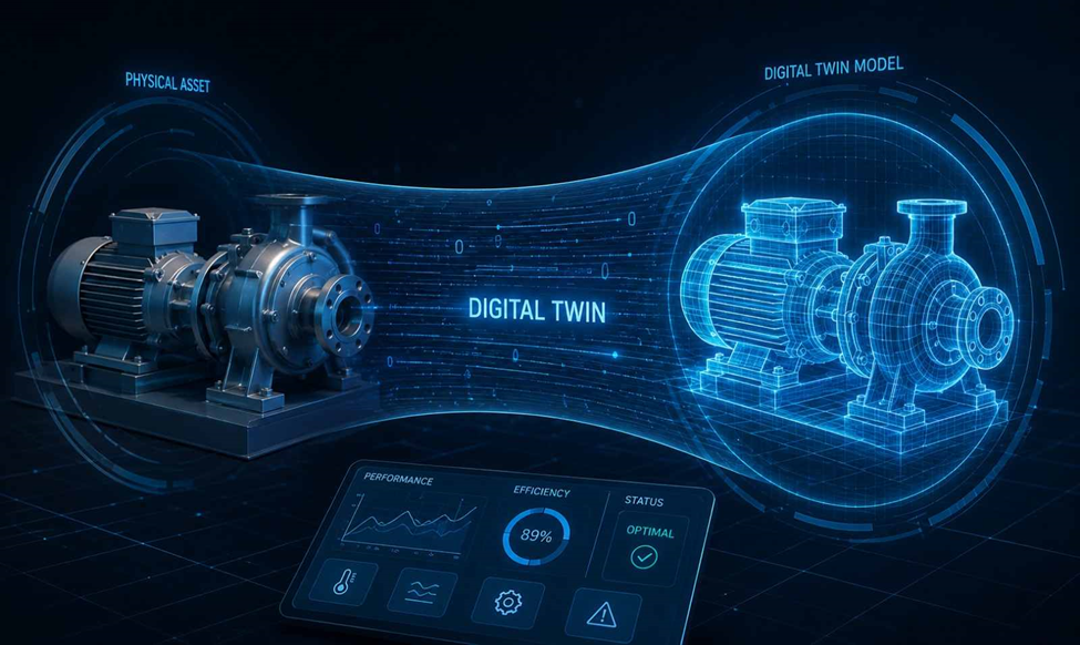
What Is Digital Twin Technology?
Digital twin technology creates a digital representation of a physical site, structure, or infrastructure asset using real-world data. In surveying, this data can come from GNSS, total stations, LiDAR, laser scanners, drones, and photogrammetry.
The digital model represents actual site conditions such as coordinates, elevations, dimensions, terrain, and asset locations. As new survey data is collected, the model can be updated to reflect changes on the ground.
Top 10 Applications of Digital Twin Technology in Surveying
1. 🛰️ Digital Twin Technology for Real-Time Site Monitoring
- Combines GNSS, total station, drone, and LiDAR survey data with a live 3D site model.
- Survey teams can compare current site conditions with the planned model.
- Useful for tracking excavation, structural progress, access routes, and site changes.
- Frequent survey updates help identify deviations before they affect construction work.
2. 🗺️ 3D Terrain Modeling for Surveying and Site Analysis
- Survey points, breaklines, and elevation data can be converted into a detailed 3D terrain surface.
- Digital twins provide a clearer view of slopes, levels, drainage paths, and existing ground conditions.
- Surveyors can compare existing terrain with proposed grading designs.
- Useful for roadworks, infrastructure projects, land development, and earthwork planning.
3. 📐 Digital Twins for Construction Survey Verification
- Field survey data can be checked against the approved design or BIM model.
- Surveyors can identify differences in levels, coordinates, alignment, and structural positions.
- Useful for checking foundations, columns, roads, slabs, and other constructed elements.
- Early detection of positional errors can reduce rework on site.
4. 🏗️ As-Built Survey Data Integration into Digital Twins
- As-built survey data records the actual position and dimensions of completed work.
- GNSS, total stations, laser scanners, and other survey equipment can supply this information.
- The captured data can be linked to the digital twin to represent current asset conditions.
- This provides a reliable reference for maintenance, modifications, and future construction.
5. 🔍 Infrastructure Inspection Using Survey-Based Digital Twins
- Bridges, roads, tunnels, buildings, and other assets can be represented through detailed digital models.
- Survey data helps record changes in geometry, surface condition, and structural position.
- New survey observations can be compared with previous datasets to identify changes.
- Engineers can use the model to plan inspection and maintenance activities.
6. 🔌 Utility Mapping and Underground Asset Visualization
- Utility survey data can be incorporated into a digital twin to represent water lines, drainage, electrical cables, and pipelines.
- GPR, electromagnetic locating, GNSS, and total station data can support accurate positioning.
- Above-ground and underground assets can be viewed within the same spatial environment.
- This helps reduce utility clashes during excavation and construction.
7. 🧩 Digital Twin Applications in BIM and Survey Coordination
- Survey information provides the spatial control needed to align BIM models with actual site conditions.
- Point clouds, control points, and coordinate data can be referenced against architectural, structural, and MEP models.
- Surveyors and BIM teams can work from a common spatial reference.
- This is especially useful when existing site conditions differ from the original design.
8. 📡 Deformation Monitoring with Spatial Survey Data
- Repeated surveys can track movement in structures, slopes, retaining walls, and other assets.
- Total stations, GNSS receivers, and laser scanners can provide periodic measurements.
- Digital twins make it easier to compare current positions with previous survey records.
- Measured changes can be reviewed against specified project tolerance limits.
9. 📊 Volume Measurement and Earthwork Progress Tracking
- Surveyed elevation data can be used to calculate cut, fill, stockpile, and excavation volumes.
- A digital twin can store different terrain surfaces from different project stages.
- Comparing these surfaces shows how much material has been moved or remains on site.
- This provides a practical basis for progress measurement and quantity verification.
10. 🏙️ Survey Data Management for Smart Infrastructure
- A digital twin brings survey observations, models, asset information, and historical records into one spatial environment.
- Updated survey data can be associated with specific locations or infrastructure elements.
- Project teams can work from consistent coordinate information and current site data.
- Over time, the digital twin becomes a useful record for asset management, maintenance, and future survey work.
Need a Land Survey?
Accurate Survey Work L.L.C provides reliable land surveying and geospatial services for construction, infrastructure, and development projects across the UAE.
Our services include Topographic Survey, Boundary Survey, GPS/GNSS Survey, Total Station Survey, As-Built Survey, Utility Survey, Setting Out Survey, Volume Calculation.
Need accurate survey data for your project? Contact Accurate Survey Work L.L.C today.
