
Introduction
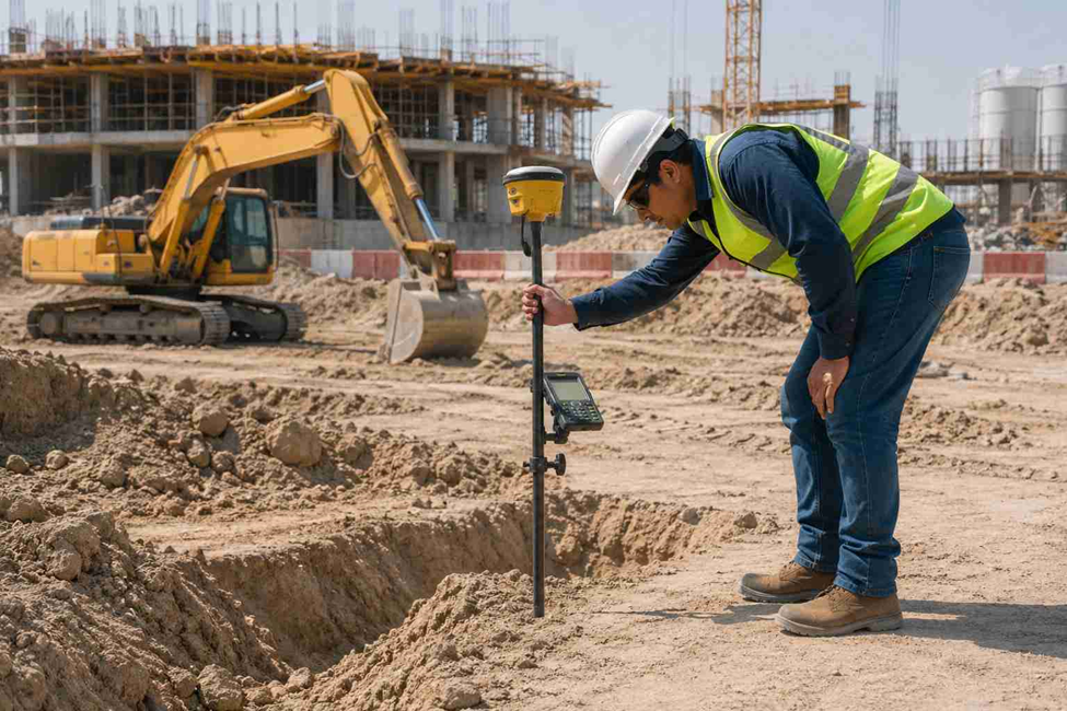
Every building project in the UAE begins with a data problem before it becomes a construction problem. Title deeds, cadastral plans, and municipality records describe a plot in the abstract — a legal boundary, a plot number, a set of coordinates. What actually exists on the ground is a physical condition: shifted boundary pegs, buried infrastructure, uneven levels, structures built past the original setback. A pre construction survey closes that gap. It’s the process of converting a legally described site into a measured one, using land and utility survey standards that architects and structural engineers can design against with confidence.
Treated as a formality, a survey gets rushed or skipped. Treated correctly, it’s the control layer every other discipline on the project — architecture, structure, MEP, civil — references back to. Get it wrong, or skip it, and the error doesn’t disappear; it resurfaces later as a redesign, a stop-work order, or a foundation that doesn’t sit where the drawings said it would.
What Is a Pre Construction Survey?
A pre construction survey is a detailed on-site assessment carried out before design finalization or groundbreaking. Professional surveyors collect accurate information about existing site conditions, including:
- Topography
- Property boundaries
- Existing structures
- Underground utilities
- Access points
- Reference levels
The collected data is compiled into survey drawings and reports that architects, engineers, and contractors use for planning and design.
Unlike a soil investigation, which evaluates subsurface ground conditions for foundation design, a pre construction survey focuses on everything above and around the ground that could affect construction.
Why a Pre Construction Survey Is Important
Construction projects rely on accurate site information. Unfortunately, the actual site often differs from plot documents or older drawings.
Examples include:
- Boundary markers that have shifted over time
- Buried foundations from demolished structures
- Underground utilities that aren’t shown on existing plans
- Ground levels altered by previous earthworks or erosion
A pre construction survey identifies these issues before design work begins, helping project teams avoid costly redesigns, construction delays, and legal disputes. For projects across the UAE, updated survey information is also required for many municipality approvals. Accurate boundary verification, setback calculations, and topographic information support smoother permit applications and reduce the likelihood of revisions.
Pre Construction Survey Checklist
A complete pre construction survey should include the following:
✓ Boundary Verification
Confirm property boundaries using title deeds, cadastral records, and municipality data to ensure the proposed development stays within legal limits.
✓ Topographic Survey
Record existing ground levels, contours, slopes, natural features, and elevation changes that influence grading, drainage, and foundation design.
✓ Existing Structures Survey
Document buildings, retaining walls, fences, pavements, foundations, and other structures that may affect demolition, renovation, or new construction.
✓ Underground Utility Survey
Locate existing:
- Water pipelines
- Sewer lines
- Stormwater drainage
- Electrical cables
- Fibre optic networks
- Gas pipelines
This helps prevent accidental utility strikes during excavation.
✓ Access and Right-of-Way Verification
Identify legal access roads, easements, service corridors, and shared access points that may affect site planning.
✓ Survey Control Points
Establish permanent control points and benchmarks that contractors will use throughout the construction process.
✓ Adjacent Property Assessment
Record neighbouring structures, shared walls, drainage patterns, retaining walls, and other nearby features that could influence construction activities.
✓ Environmental and Site Hazard Assessment
Identify:
- Trees
- Water bodies
- Steep slopes
- Flood-prone areas
- Soft ground
- Restricted zones
Understanding these conditions helps reduce project risks during construction.
Every item in this checklist contributes to better planning, more accurate engineering design, and fewer surprises during construction.
Equipment Used for a Pre Construction Survey
Modern pre construction surveys use advanced surveying technology to achieve high accuracy.
Common equipment includes:
Total Station
Measures horizontal and vertical angles along with distances for accurate boundary surveys, construction layout, and mapping.
GNSS / GPS Survey Equipment
Provides highly accurate coordinates connected to national geodetic reference systems.
Dumpy Level
Measures elevation differences and assists with topographic surveys, drainage planning, and earthwork calculations.
Ground Penetrating Radar (GPR) & Utility Locators
Detect buried pipes, electrical cables, telecom lines, and underground infrastructure without excavation.
Drone Survey
Captures aerial imagery, orthophotos, and terrain models for large sites quickly and efficiently.
3D Laser Scanner
Creates highly detailed point cloud data of buildings, industrial facilities, and complex structures for accurate modelling and measurements. The combination of equipment depends on project size, terrain, and the level of detail required.
Who Needs a Pre Construction Survey?
A pre construction survey is valuable for almost every type of development project.
Typical clients include:
- Property developers
- Landowners
- Architects
- Structural engineers
- Civil engineers
- Building contractors
- Infrastructure contractors
- Industrial developers
- Government agencies
- Property buyers
Whether constructing a villa, warehouse, commercial building, road, or utility network, accurate survey data forms the basis of successful project planning.
Benefits of Completing the Checklist
Completing a professional pre construction survey offers several advantages.
- Reduced design revisions through accurate site information
- Fewer construction delays caused by unexpected site conditions
- Faster municipality approvals with complete survey documentation
- Improved coordination between architects, engineers, and contractors
- Lower risk of boundary disputes and legal issues
- Better excavation planning
- More accurate quantity estimation
- Reduced project costs
- Increased construction safety
- Better long-term project quality
Ultimately, accurate survey data removes uncertainty from the earliest stages of construction.
Common Mistakes to Avoid
Avoid these common mistakes before beginning construction:
- Using outdated subdivision or cadastral plans
- Skipping underground utility detection
- Ignoring neighbouring property conditions
- Failing to verify property boundaries
- Using poorly calibrated surveying equipment
- Hiring inexperienced surveying companies
- Treating the survey as a permit formality rather than a design tool
These mistakes often lead to expensive delays once construction has already started.
Why Professional Surveying Matters in the UAE
Construction projects in the UAE face unique challenges.
Many developments are located on reclaimed land, while others involve complex municipal coordinate systems, dense underground utility corridors, and rapidly developing urban environments.
Professional surveyors familiar with UAE municipality requirements understand local coordinate systems, submission standards, and surveying regulations. They also use modern surveying equipment to produce accurate drawings that meet approval requirements.
Choosing an experienced surveying company helps reduce project risks, speeds up approvals, and provides reliable data throughout the construction process.
Frequently Asked Questions
Q1. How long does a pre construction survey take?
For a standard building plot, fieldwork usually takes between one and three days. The survey team then typically delivers the finished drawings and report within a few additional working days, depending on the size and complexity of the site.
Q2. Is a pre construction survey mandatory in the UAE?
Most UAE municipalities require current survey information — including verified boundaries and topographic data — before approving a building permit application, so in practice it functions as a required step for nearly every project rather than an optional one.
Q3. What’s the difference between a pre construction survey and a soil investigation?
A pre construction survey documents what’s on and around the site, such as boundaries, elevations, existing structures, and utilities, while a soil investigation looks beneath the surface to assess soil properties for foundation design. Because they answer different engineering questions, most projects end up needing both.
Q4. Can a pre construction survey change the building design?
Yes. Once architects and engineers see the actual site conditions, survey findings often lead to adjustments in the building’s position, foundation layout, drainage design, utility routing, earthwork quantities, and site access planning — changes that are far cheaper to make on paper than after construction starts.
Q5. Should a survey be updated if construction is delayed?
Yes. If a project sits idle for several months, or the surrounding site changes in that time, commissioning an updated survey is worth the cost, since it keeps the design working from current, accurate conditions rather than a snapshot that may no longer hold true.
Conclusion
A pre construction survey is far more than a permit requirement—it provides the accurate site data that supports every stage of a successful construction project.
From verifying property boundaries and mapping topography to locating underground utilities and establishing control points, every survey task reduces uncertainty before construction begins. Investing in a professional survey helps minimise design changes, prevent costly delays, improve regulatory compliance, and keep projects on schedule.
ASW Abu Dhabi provides professional pre construction surveys, topographic surveys, boundary surveys, and construction surveying services using advanced Total Stations, GNSS/GPS systems, 3D laser scanners, and drone surveying technology. Contact our team today to schedule your site survey and begin your project with confidence.
