
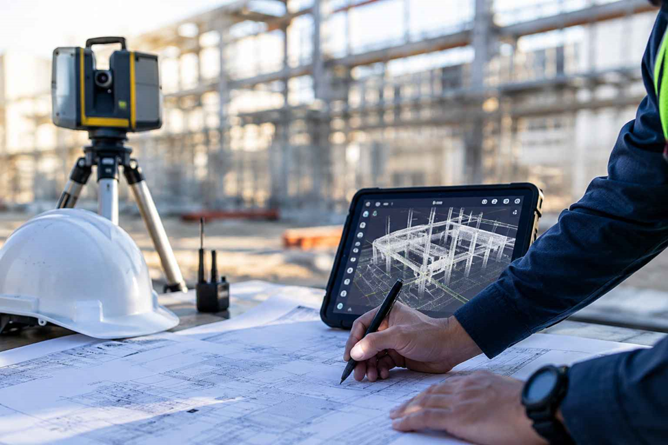
Most project owners get a land survey done once, at the start, and assume that’s the surveying taken care of. It isn’t. That single survey tells you what the site looked like on day one — it says nothing about whether the building coming up out of the ground actually matches the drawings. That’s a different job, and it runs the whole way through the project, not just at the beginning.
Two Different Jobs, Often Confused as One
- A land survey is a snapshot — boundaries, existing levels, what’s there before anyone breaks ground
- Construction surveying is continuous — checking positions, levels, and alignment at every stage as the building goes up
- Get only the first one, and problems can show up after they’re already poured into concrete, not before
- Treating the initial survey as the only survey leaves a gap between the design and what is actually built
The two surveys work together, but they answer different questions. Land surveying tells you what you are starting with. Construction surveying checks whether the work stays where it is supposed to be.
Setting Out Comes Before the Concrete, Not After
Setting out is where the approved design gets transferred onto the actual site.
- Setting out marks the exact position of columns, walls, foundations, grid lines and other elements from the approved drawings
- Once concrete is poured, there is very little room to correct a positioning error without costly rework
- On a multi-storey build, a small error on the ground floor can carry through the floors above it
- Critical positions are rechecked at different stages instead of relying on one measurement at the start
This is where a construction surveyor earns their place on site. The job isn’t simply to mark a point and leave. The position needs to be checked as construction moves forward.
Control Points Keep the Whole Project on the Same Reference
A construction project needs fixed survey references that can be used throughout the work. These control points provide the basis for setting out, level checks, structural positioning and the final as-built survey.
- Benchmarks provide a consistent elevation reference
- Control points allow different survey teams to work from the same coordinate system
- Points that are damaged, disturbed or moved during construction need to be checked before they are used again
- Reliable control makes it easier to compare survey results from different stages of the project
It is easy to overlook control points when everything is going smoothly. When two survey teams produce different positions for the same element, though, the importance becomes obvious.
Nothing Gets Dug Until Someone Knows What’s Underground
Excavating near buried infrastructure without checking first is one of the more expensive mistakes a UAE site can make.
Utility authorities such as DEWA may require approvals or NOCs before work near existing underground services, depending on the location and scope of the work and that typically means showing exactly how close the work will come to existing infrastructure, along with the safe working distances the authority sets for the area. Projects affecting public roads can also involve RTA requirements, including approvals, access arrangements and working restrictions that may limit hours or routes during the works.
A utility survey can help identify the position and depth of existing services before excavation starts. Survey information can then be used alongside utility records, approved drawings and NOC documentation.
Skip this step and the risk isn’t just paperwork it’s hitting a live cable, water line or other service during excavation and bringing the work to a stop.
Big Sites Move While They’re Being Built
Towers, infrastructure jobs and multi-phase developments need more than a one-time position check. Survey teams can use Total Stations, GNSS and GPS equipment at planned intervals to check position, elevation, alignment and movement.
On a 40-storey building, a small positional difference on one level can become a much larger coordination issue as construction moves upward. Regular checks give the project team a chance to spot the difference while it is still manageable.
Where movement monitoring is required, survey observations can also be compared over time to identify changes in the structure or surrounding ground.
Floor Levels and Verticality Need Checking Too
Construction surveying isn’t only about marking where something starts. Surveyors also check whether what has been built is staying where it should be.
Depending on the structure, checks can include:
- Floor-to-floor elevations
- Column and wall positions
- Verticality of structural elements
- Slab levels
- Openings and embedded items
- Alignment between different floors
These checks become particularly important on tall buildings. A small positional difference that seems insignificant on one floor can affect façade alignment, MEP installation and structural coordination further up.
External Works Need Surveying as Well
The survey work doesn’t stop when the main structure is complete.
Roads, kerbs, drainage, paving, landscaping and other external works also depend on correct levels and positions, including the gate level computation that ties the entrance and driveway back to the road and finished plot levels.
A wrong level can affect drainage flow. An incorrect kerb position can affect road connections. A small difference in finished ground levels can also create problems where the building meets external areas.
Checking these elements during construction makes corrections much easier than discovering the problem after the work is finished.
Survey Data Has to Match the Drawings
One of the less obvious problems on construction sites is when the survey team and design team are working from different information.
A revised drawing may change a grid line. A design change may move a wall. A site condition may require an adjustment that isn’t reflected in an older drawing.
That is why surveyors need to work from the current approved drawings and revisions, not simply the first set they received. CAD-prepared drawings kept in sync with site conditions make this handoff far more reliable.
Before setting out important elements, the survey team should confirm:
- Drawing revision
- Coordinate system
- Benchmark and control information
- Grid lines
- Required levels
- Latest approved layout
A correct measurement taken from an outdated drawing is still the wrong setting out.
The As-Built Survey Is What Confirms You Actually Built What Was Approved
Depending on the project and authority, an as-built survey may be required to document the completed structure and confirm its position, levels and dimensions against the approved information.
This is where an as-built survey earns its keep: it identifies differences before the project reaches its final approval or handover stage. In Dubai, unresolved non-compliance found at inspection stage can trigger stop-work notices and fines that authorities have set as high as AED 50,000, along with rectification costs at the owner’s expense — a far higher price than catching the same issue during construction.
Finding a discrepancy while the site team is still working is one thing. Finding it after finishes are complete, documents have been submitted and the project is ready for handover is another.
Why the Survey Team Needs to Stay Involved
One survey at the beginning and another at the end leaves a lot happening in between.
A construction surveyor may be involved in:
- Initial site control
- Setting out foundations and structural elements
- Level and alignment checks
- Utility and excavation surveys
- Floor-to-floor checks
- Monitoring and deformation checks where required
- External works and drainage levels
- Final as-built surveys
The exact scope depends on the project, but the principle is simple: survey information needs to keep pace with construction.
What Happens When Construction Surveying Is Skipped?
The problem isn’t always obvious on day one.
A foundation can be slightly out of position. A column can be a few millimetres away from its intended grid line. A floor can finish at the wrong level. By themselves, these differences may look minor.
The problem comes when the next trade builds on them.
A small setting-out difference can affect:
- Structural connections
- MEP installation
- Façade alignment
- Door and window openings
- Floor finishes
- External drainage
- Final as-built documentation
The earlier a difference is found, the easier it usually is to deal with.
Need Surveying Support?
A land survey gets your project started on solid ground literally. Construction surveying is what keeps that accuracy holding through control establishment, setting out, utility clearance, level checks, structural alignment, monitoring, external works and the final as-built check.
The two services are not competing alternatives. They are different parts of the same construction process.
Land surveying tells you what you are starting with. Construction surveying helps make sure you build it in the right place.
Accurate Survey Work L.L.C. has handled both ends of this for over 11 years — with 250+ completed projects across the UAE, a team of 60+ surveyors and 20+ engineers.
