
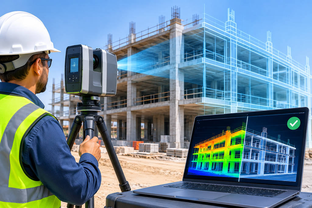
A drawing shows what the team intends to build. The site shows what the team actually built. On most projects, the two differ by a small amount, and the cost of that gap depends on how early someone finds it.
A 3D laser survey measures the finished work in detail and compares it with the design. This article explains what that check involves, which elements it covers, how the comparison works, and how to plan it so the results arrive while changes are still cheap.
What Is a 3D Laser Survey in Construction?
A 3D laser survey records the visible surfaces of a structure as a dense cloud of measured points. On a construction project, the team uses that record for verification. Instead of checking a few spots with a tape or a level, it checks every visible surface in the scanned area.
The result is a measured copy of the work as it stands. Engineers can then compare that copy with the design drawings or the model. The 3D laser scanning service provides the field data for this type of check.
Why Construction Teams Verify Built Work Against the Design
Small deviations add up. A column that leans, a slab that dips or a wall that sits a few centimetres off its line can affect the work that follows. Cladding, lifts, ceilings and services all depend on the surfaces beneath them.
Verification finds these problems early. It also settles disputes with facts. When a consultant, contractor and client disagree about what the site shows, a measured record answers the question without argument. Finally, it protects the handover, because the team can prove that the structure meets its specification.
Key Checks a 3D Laser Survey Can Perform
Because the point cloud covers whole surfaces, one survey supports many checks.
- Flatness of floors and slabs, measured as the variation of the surface from a true plane.
- Verticality of columns and walls, measured as the lean from a true vertical line.
- Levels and heights, measured at any point on the surface instead of at a few chosen points.
- Dimensions and alignment, such as wall lengths, opening sizes and grid positions.
- Clearances, such as the space under beams or around equipment.
Engineers extract each measurement from the same dataset, so a new question rarely needs a new site visit.
How Deviation Analysis Works: Comparing the Point Cloud with the Model
Deviation analysis is the heart of the process. The survey team places the point cloud and the design model in the same coordinate system. Software then measures the distance from each scanned point to the nearest design surface.
The team presents the result as a colour map. Green areas match the design. Warm and cool colours show where the built surface sits above or below the design, and by how much. Anyone can read the map at a glance, even without a survey background.
This method relies on good alignment. A proper tie to control points places the scan and the design in the same position. Without that tie, the comparison shows false differences. The design model may come from a BIM model or from CAD drawings.
Typical Applications: Slabs, Facades, Steelwork and Services
The method suits many parts of a building.
- Concrete slabs and floors, before screed, tiling or equipment installation.
- Columns, walls and cores, which support the work above them.
- Facades and cladding frames, where small errors multiply across hundreds of panels.
- Structural steelwork, to check connections and positions before fabrication of the next stage.
- Building services, to record the position of pipes and ducts before ceilings and walls close.
The 3D laser scanner for buildings article describes how teams capture existing structures. The verification use goes one step further and measures new work against its design.
Tolerances, Reporting and Acceptance Criteria
A measurement only matters when someone knows the limit it must meet. Project specifications and standards set the tolerances for flatness, verticality and position. Agree these limits before the survey, and write them into the brief.
The survey method must also be comfortably tighter than the tolerance it checks. A survey that carries an error close to the tolerance cannot prove compliance either way. Ask the provider to state the expected accuracy and how it will confirm it with independent check points.
A strong report includes the deviation maps, a table of measured values against the design, section drawings at agreed locations and a clear statement of pass or fail for each element. The team can also supply drawings of the as-built condition when the design must be updated.
Planning a 3D Laser Verification Survey: Timing and Deliverables
Timing decides the value of the survey. Scan each element after the work is complete but before the next trade covers it. For a slab, that means after finishing and before fit-out. For services, it means before ceilings and walls close. Scanning after cover-up costs more, because the team must open the work to reach it.
Keep the site accessible during the scan, and tell the team about any areas that will change soon. Remember that a laser records only what it can see, so hidden elements need scanning earlier. Also confirm the deliverables, file formats and coordinate system in advance. For building projects in Abu Dhabi, check the inspection and approval requirements of the Department of Municipalities and Transport before the handover date is fixed.
The 3D laser scanning guide explains what a scan can and cannot capture, which helps when you plan coverage.
Conclusion
A 3D laser survey turns construction verification from a set of spot checks into a complete, measured comparison. It finds deviations while corrections remain affordable, and it gives every party the same evidence. Agree the tolerances, tie the survey to control, scan before the next trade covers the work and ask for a clear report. Those steps turn the point cloud into a decision tool.
Frequently Asked Questions
What does a 3D laser survey check on a construction site?
It measures flatness, verticality, levels, dimensions and alignment across whole surfaces and compares them with the design.
What is deviation analysis?
It compares each scanned point with the design model and shows the differences as a colour map.
When should I scan the work?
Scan each element when it is finished and before the next trade covers it, such as before ceilings close.
Can a 3D laser survey replace traditional checks?
It complements them. It covers whole surfaces quickly, while a total station or level still suits a few precise points.
What do I receive after the survey?
Typical deliverables include deviation maps, measured-against-design tables, section drawings and the point cloud.