
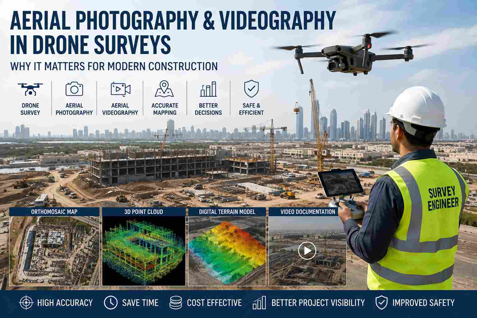
Surveying used to mean a crew on foot, a total station, and hours of walking a site. Drones changed that. Today, a single flight can capture a site in far more detail than a traditional survey team could gather in a full day, and that shift is largely thanks to aerial photography and videography. In this post, we’ll break down what drone surveys actually involve, how aerial imagery fits in, what technology and rules apply in the UAE, and why it’s become a standard part of engineering and construction projects across the country.
What Is a Drone Survey?
A drone survey uses an unmanned aerial vehicle (UAV) fitted with cameras or sensors to capture site data from above, instead of relying only on ground-based instruments.
Conventional surveying is point-by-point work. A surveyor sets up equipment, takes a reading, moves, and repeats. It’s accurate, but slow, and it struggles on large or hard-to-access sites. A drone mapping survey covers the whole area in one pass, capturing thousands of data points in the time it takes to walk a fraction of that ground. It doesn’t replace ground control entirely — RTK/PPK GNSS points are still needed for accuracy — but it drastically cuts down field time and gets a topographic survey done in a fraction of the usual schedule.
Most drone surveys today combine aerial imagery with traditional control points on the ground, which is what ties the aerial data to real-world coordinates and keeps accuracy within the tolerances engineers actually need.
What Is Aerial Photography and Videography in Surveying?
In a survey context, aerial photography means high-resolution still images taken from a drone, usually with heavy overlap so they can be stitched together into a single, geometrically accurate map. Aerial videography is continuous footage — often used for site walkthroughs, stakeholder presentations, or visual inspections that need to be seen rather than measured.
The two aren’t interchangeable. Photography is the raw material for measurable outputs — orthomosaics, elevation models, volume calculations. Videography is more about communication: showing a client or consultant what a site actually looks like without them having to visit.
Typical data collected on a flight includes:
- Overlapping RGB images for photogrammetry
- Orthomosaic maps (a flat, geometrically corrected image of the whole site)
- 3D point clouds and terrain models
- Video footage for progress records, walkthroughs, or inspection reporting
How Drone Surveys Benefit from Aerial Photography and Videography
Accurate site documentation. Every stage of a project gets a visual record, not just a set of coordinates. That matters when disputes come up, when a contractor needs proof of work completed, or when as-built documentation needs to match what’s on the drawings.
Faster data collection. A drone flight over several hectares takes minutes. The same coverage on foot, with a total station or GPS rover, could take days. We’ve covered how ground-based instruments compare in our post on how total station data is used in CAD, BIM, and GIS — drones don’t replace that workflow, they feed into it.
Better project visualization. Orthomosaics and 3D models are far easier for clients, consultants, and contractors to read than a spreadsheet of coordinates. A video walkthrough can settle a design question faster than a meeting.
Improved measurement accuracy. Combined with RTK/PPK GNSS ground control, photogrammetry from aerial imagery can match traditional survey precision over large or irregular terrain, and in some cases outperform it simply because of the sheer density of data points captured.
Applications in Engineering and Construction
- Topographic Survey — generating accurate terrain models for design and planning, feeding straight into CAD services
- Construction Progress Monitoring — tracking site development week over week with consistent aerial records that stakeholders can compare over time
- Earthwork Volume Calculation — measuring cut and fill quantities without manual cross-sectioning, saving days of fieldwork
- Infrastructure Inspection — reviewing towers, roofs, and structures that are difficult or unsafe to access on foot
- Utility Corridor Mapping — documenting pipeline and utility survey routes across long stretches of land
- As-Built Documentation — recording the final state of a project against original design drawings, often feeding into BIM modeling for facility management
If a project also needs indoor or as-built 3D data beyond what a drone can capture, that’s usually where terrestrial laser scanning comes in — we go into that in our Scan to BIM Revit services post.
Technologies Used in Drone Survey
- UAV (Drone Platform) — the aircraft itself, chosen based on site size, payload, and flight endurance needs
- RTK/PPK GNSS — ground control that ties the aerial data to real-world coordinates, the same principle behind our GPS survey work
- High-Resolution RGB Cameras — for photogrammetry and visual documentation
- LiDAR — used where vegetation or obstructions make photogrammetry alone less reliable, since laser pulses can penetrate gaps that a camera can’t see through
- Photogrammetry Software — processes overlapping images into orthomosaics, point clouds, and 3D models, following the same principles the American Society for Photogrammetry and Remote Sensing (ASPRS) sets out as industry standard for accuracy and reporting
Regulations to Know Before You Fly
Aerial photography and videography in the UAE isn’t a fly-and-shoot operation. All commercial drone activity is regulated by the General Civil Aviation Authority (GCAA), and any flight involving photography or videography for business purposes needs proper registration and, in most cases, a permit. That includes a UAS Operator Certificate, a Remote Pilot Licence for each operator, and flight approval for the specific site and airspace. Flying near airports, government buildings, or restricted zones adds further layers of approval.
This is one of the reasons it’s worth working with an established survey company rather than a freelance drone operator — non-compliant flights can put a project at legal risk, and data collected outside proper authorization can be challenged later. You can find the current rules directly from the GCAA, which is the official regulator for all UAV operations in the UAE.
Advantages of Drone-Based Aerial Photography and Videography
- Reduced time in the field, which shortens project timelines
- Safer data collection — no need to send crews into hazardous or hard-to-reach areas
- High-resolution mapping across large sites in a single flight
- Cost-effective coverage compared to traditional ground methods
- Digital deliverables that plug straight into CAD, BIM, and GIS workflows without extra conversion steps
Conclusion
Aerial photography and videography have moved from a nice-to-have to a core part of how surveys get done. They speed up data collection, improve accuracy, and give everyone on a project — from engineers to clients — a clearer picture of what’s actually happening on site. Add in the UAE’s clear regulatory framework through the GCAA, and it’s a service that needs to be handled by people who know both the technical and compliance side. For any construction or infrastructure project in the UAE, a drone survey is worth having in the plan from day one.
Need accurate survey data for your next project?
Accurate Survey Work L.L.C. delivers precise, reliable results across Topographic Survey, 3D Laser Scanning, and Utility Survey — backed by 11+ years of experience and modern drone and mapping technology. Contact us today to discuss your project requirements.
Frequently Asked Questions
What is the purpose of aerial photography in drone surveys? It captures high-resolution imagery of a site that can be processed into maps, models, and measurable data — giving a complete visual and spatial record without walking every inch of ground.
How accurate are drone surveys? With proper ground control (RTK/PPK GNSS), drone surveys can achieve centimeter-level accuracy, comparable to traditional survey methods, while covering far more ground in less time.
Can drone surveys be used for topographic mapping? Yes. Drone-captured imagery, processed through photogrammetry, is one of the most common ways to generate accurate topographic surveys and terrain models today.
What industries use aerial photography and videography? Construction, infrastructure, real estate development, utilities, and land development all rely on aerial data for planning, monitoring, and documentation.
What deliverables are produced from a drone survey? Typical outputs include orthomosaic maps, 3D terrain models, point clouds, progress videos, and data formatted for CAD, BIM, and GIS platforms.
Do you need a permit to fly a drone commercially in the UAE? Yes. Any commercial drone flight involving photography or videography requires GCAA registration, a Remote Pilot Licence, and flight approval for the site and airspace involved.
