
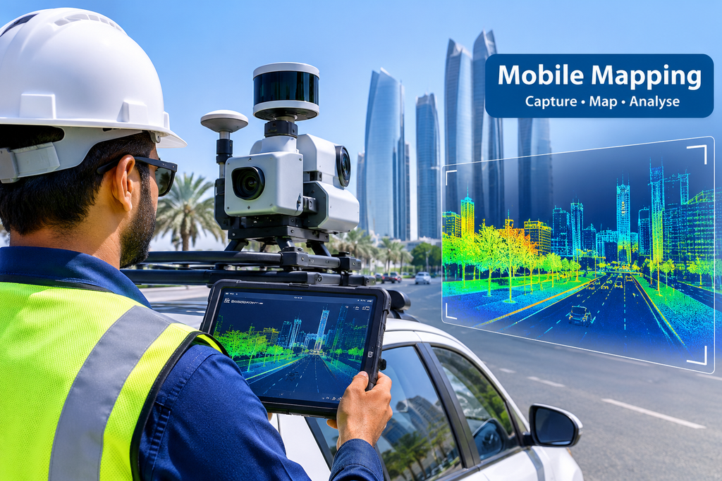
A survey crew on foot takes days to cover a long road. A vehicle with the right equipment can cover the same road in one drive. That is the basic idea behind a mobile mapping system. This post explains how it works, what it records, and how to check the data you get back.
What Is a Mobile Mapping System?
A mobile mapping system is a set of survey sensors fitted on a moving vehicle. The vehicle drives along the road at normal speed. While it moves, the sensors record everything around it.
- It works like a scanner on wheels.
- It measures the road and its surroundings in 3D.
- It also takes photos, so you can see what the measurements show.
You do not need to close the road or send people to stand on it. That alone makes it a good fit for busy roads.
What Is Fitted on the Vehicle and What Each Part Does
Each part has one job. Together, they give you a map you can trust.
- Laser scanner: It sends out laser pulses and measures how long they take to bounce back. This gives the distance to every surface.
- GNSS receiver: It uses satellites to find where the vehicle is on the earth.
- IMU (motion sensor): It tracks tilt and turns, so the system knows how the vehicle moves between satellite readings.
- Cameras: They take photos along the route. These help you recognise signs, markings and buildings.
- Control computer: It records and syncs all the data on the same clock.
The sensors only work well as a team. The laser is useful only because the system always knows where it was and which way it was pointing.
How One Drive Turns Into Millions of Measured Points
The laser scanner fires thousands of pulses every second. Each pulse that hits a surface becomes one point with an exact position. After a few minutes of driving, you have millions of points. Together, they form a point cloud, a 3D picture made of dots.
Here is the process in order:
- The vehicle drives the planned route.
- The sensors record laser, position, motion and photo data.
- The team processes the data in the office and joins it into one model.
- The team checks the model against known survey points on the ground.
Step 4 matters a lot. It ties the data to real coordinates, which is why control points are part of a good mobile mapping job.
What Gets Captured: Road, Roadside and Buildings
One drive records much more than the road surface.
- The road: edges, lanes, markings, levels and surface changes
- The roadside: kerbs, drains, light poles, signs, barriers and trees
- The buildings: fronts, heights and distances from the road
- Structures overhead or nearby: bridges, gantries and walls
Because everything sits in one model, you can measure it later from your desk. If you forgot to ask for a measurement, you often do not need to send a crew back to the site.
How Accuracy Is Kept Under Bridges, Tunnels and Tall Buildings
Satellites do not reach everywhere. Under a bridge, inside a tunnel, or between tall towers, the GNSS signal can drop or bounce. This is the biggest weak spot of any mobile mapping system.
Surveyors handle it in a few ways:
- The motion sensor keeps tracking the vehicle during short signal gaps.
- Ground control points give the data fixed positions to hold on to.
- The team plans the route and the timing to avoid the worst signal problems.
- The team re-drives weak sections if needed.
For long gaps, such as tunnels, extra ground checks become even more important. A good team will tell you where the signal was weak instead of hiding it.
What You Receive After the Drive: Point Cloud, Drawings and Maps
The raw data is only the start. Most clients want files they can use right away.
- Point cloud: the full 3D model of the route
- Photos: panoramic or route images linked to the map
- CAD drawings: lines and symbols for design work (see our CAD services)
- Surface models and levels: useful for road and drainage design
- Asset maps: poles, signs and kerbs placed on a map
Tell the survey team how you plan to use the data before the drive. That way they deliver the right files and not just a large point cloud you cannot open.
How to Check the Data Before You Accept It
Do not accept the data only because it looks good on screen. A few simple checks can save you trouble later.
- Ask for the accuracy report and see how it was measured.
- Pick a few spots on the road and compare the model with known levels or distances.
- Look for gaps, double images or shifted lines where the signal was weak.
- Check that coordinates and levels use the system you asked for.
- Open the files yourself before you sign off.
A good survey team welcomes these checks. If you want to compare methods, read about 3D laser scanning for buildings and small areas, or GPS survey for single points.
Conclusion
A mobile mapping system saves time because it records a whole corridor in one pass. It does not replace every survey method. It works best on roads, long routes and wide areas, and it needs good control points and honest quality checks. Once you know what the vehicle captures, you can ask better questions and get data you can use. If you plan a mapping project in the UAE, you can contact our team to discuss the route and the files you need.
FAQs
1. How fast can a mobile mapping system map a road?
It records at normal driving speed. A long road can be done in hours, not days. The office work then takes extra time.
2. Is a mobile mapping system accurate enough for design work?
Yes, when the team uses good control points and checks the data. Accuracy depends on the signal, the route and the sensors.
3. Does the road need to be closed?
Usually no. The vehicle drives with the traffic. Your survey team will plan the safest time.
4. Can it map places without a satellite signal?
For short gaps, yes. The motion sensor fills in. For long gaps like tunnels, the team adds ground checks.
5. What should I ask for before the drive?
Ask which files you will get, which coordinate system they use, and how the team will check accuracy.